
庙子镇 topographic map
Interactive map
Click on the map to display elevation.
About this map
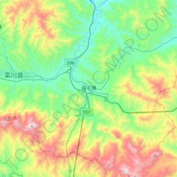
Name: 庙子镇 topographic map, elevation, terrain.
Location: 庙子镇, 栾川县, 洛阳市, 河南省, 中国 (33.65602 111.65889 33.87838 111.86261)
Average elevation: 3,648 ft
Minimum elevation: 1,965 ft
Maximum elevation: 7,060 ft
Other topographic maps
Click on a map to view its topography, its elevation and its terrain.