Geolocate

Jumbo topographic map

Click on the map to display elevation.

About this map

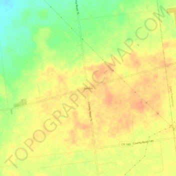
Name: Jumbo topographic map, elevation, terrain.

Location: Jumbo, McDonald Township, Hardin County, Ohio, United States (40.57505 -83.77799 40.61505 -83.73799)

Average elevation: 1,060 ft

Minimum elevation: 974 ft

Maximum elevation: 1,109 ft

Hardin County trails, hiking, mountain biking, running and outdoor activities

Other topographic maps

Click on a map to view its topography, its elevation and its terrain.

Ada

United States > Ohio > Hardin County

Average elevation: 961 ft

Alger

United States > Ohio > Hardin County

Average elevation: 997 ft

Dunkirk

United States > Ohio > Hardin County

Average elevation: 942 ft

Forest

United States > Ohio > Hardin County

Average elevation: 928 ft

McGuffey

United States > Ohio > Hardin County

Average elevation: 971 ft

Mount Victory

United States > Ohio > Hardin County

Average elevation: 1,040 ft

Patterson

United States > Ohio > Hardin County

Average elevation: 922 ft

Ridgeway

United States > Ohio > Hardin County

Average elevation: 1,060 ft

Buck Township

United States > Ohio > Hardin County

Average elevation: 994 ft

Gear up for your next adventure:

🧦Hiking Socks - Comfortable socks to prevent blisters on long hikes
🧭Orienteering Set - Complete compass and map reading kit
📡Handheld GPS Device - Reliable handheld GPS for outdoor navigation
🚁Photography Drones - Capture stunning aerial views of landforms and topography
🧭GPS Watch Accessories - Bands and chargers for GPS watches

As an Amazon Associate, this site earns from qualifying purchases at no extra cost to you.