Geolocate

Ridgeway topographic map

Click on the map to display elevation.
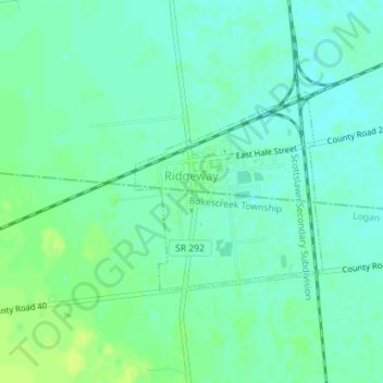
About this map

Name: Ridgeway topographic map, elevation, terrain.

Location: Ridgeway, Hale Township, Hardin County, Ohio, United States (40.50602 -83.57853 40.52013 -83.56105)

Average elevation: 1,060 ft

Minimum elevation: 1,040 ft

Maximum elevation: 1,086 ft

Hardin County trails, hiking, mountain biking, running and outdoor activities

Other topographic maps

Click on a map to view its topography, its elevation and its terrain.

Roundhead

United States > Ohio > Hardin County

Located at an altitude of 1,004 feet (306 m), it sits at the intersection of State Routes 117, 235, and 385, 2.75 miles (4.43 km) north of the northeast corner of Indian Lake and 13 miles (21 km) southwest of the city of Kenton, the county seat of Hardin County. Despite Roundhead's proximity to Indian Lake and…

Average elevation: 1,020 ft

Dola

United States > Ohio > Hardin County

Average elevation: 945 ft

Blanchard

United States > Ohio > Hardin County

Average elevation: 948 ft

Grant

United States > Ohio > Hardin County

Average elevation: 932 ft

Hepburn

United States > Ohio > Hardin County

Average elevation: 965 ft

Jump

United States > Ohio > Hardin County

Average elevation: 994 ft

Mentzer

United States > Ohio > Hardin County

Average elevation: 1,007 ft

Pfeiffer

United States > Ohio > Hardin County

Average elevation: 965 ft

Yelverton

United States > Ohio > Hardin County

Average elevation: 1,079 ft

Walton

United States > Ohio > Hardin County

Average elevation: 984 ft

Jumbo

United States > Ohio > Hardin County

Average elevation: 1,060 ft

Foraker

United States > Ohio > Hardin County

Average elevation: 968 ft

Grassy Point

United States > Ohio > Hardin County

Average elevation: 1,053 ft

Huntersville

United States > Ohio > Hardin County

Average elevation: 978 ft

Silver Creek

United States > Ohio > Hardin County

Average elevation: 1,076 ft

WKTN-FM (Kenton)

United States > Ohio > Hardin County

Average elevation: 978 ft

Holden

United States > Ohio > Hardin County

Average elevation: 1,040 ft

Gear up for your next adventure:

🧥Waterproof Jacket for Hiking - Breathable and rugged rain jacket for outdoor excursions
📦Gear Storage Bags - Organize and protect outdoor equipment
🌎3D Topographic Globes - Raised relief globes for a tactile understanding of geography
🎒Day Hiking Backpack - Lightweight backpack perfect for day trips and outdoor adventures
🌡️Portable Weather Meter - Track weather conditions on the trail

As an Amazon Associate, this site earns from qualifying purchases at no extra cost to you.