Geolocate

Mentzer topographic map

Click on the map to display elevation.

About this map

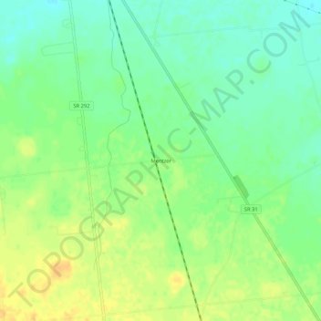
Name: Mentzer topographic map, elevation, terrain.

Location: Mentzer, Buck Township, Hardin County, Ohio, United States (40.57672 -83.60160 40.61672 -83.56160)

Average elevation: 1,007 ft

Minimum elevation: 961 ft

Maximum elevation: 1,056 ft

Hardin County trails, hiking, mountain biking, running and outdoor activities

Other topographic maps

Click on a map to view its topography, its elevation and its terrain.

Ada

United States > Ohio > Hardin County

Average elevation: 961 ft

Kenton

United States > Ohio > Hardin County

Average elevation: 981 ft

Alger

United States > Ohio > Hardin County

Average elevation: 997 ft

Dunkirk

United States > Ohio > Hardin County

Average elevation: 942 ft

Forest

United States > Ohio > Hardin County

Average elevation: 928 ft

McGuffey

United States > Ohio > Hardin County

Average elevation: 971 ft

Mount Victory

United States > Ohio > Hardin County

Average elevation: 1,040 ft

Patterson

United States > Ohio > Hardin County

Average elevation: 922 ft

Ridgeway

United States > Ohio > Hardin County

Average elevation: 1,060 ft

Buck Township

United States > Ohio > Hardin County

Average elevation: 994 ft

Gear up for your next adventure:

🎒Day Hiking Backpack - Lightweight backpack perfect for day trips and outdoor adventures
🎒Trail Energy Bars - High‑calorie bars for hiking energy
🧥Men's Rain Shells - Premium waterproof and breathable jackets for mountain weather
Camping Coffee Makers - Enjoy premium coffee at the summit or campsite
🔌USB Car Charger - Car charger for on‑the‑go power needs

As an Amazon Associate, this site earns from qualifying purchases at no extra cost to you.