Geolocate

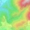
Rising Star topographic map

Click on the map to display elevation.

About this map

Name: Rising Star topographic map, elevation, terrain.

Location: Rising Star, Dharamshala, Kangra, Himachal Pradesh, 176200, India (32.21045 76.41106 32.21055 76.41116)

Average elevation: 7,448 ft

Minimum elevation: 5,322 ft

Maximum elevation: 9,790 ft

Other topographic maps

Click on a map to view its topography, its elevation and its terrain.
Balh

India > Himachal Pradesh > Dharamshala > Dharamshala

Average elevation: 6,253 ft

Gear up for your next adventure:

🧺Microfiber Travel Towels - Compact and fast-drying towels for trail use
🚑Emergency Bivvies - Heat-reflective sleeping bags for survival situations
🧣Merino Neck Gaiters - Multi-functional headwear for wind and sun protection
🧴Hand Sanitizer - Keep hands clean while hiking
🛡️Bear Spray Outdoor - Protection in bear country hikes

As an Amazon Associate, this site earns from qualifying purchases at no extra cost to you.