Geolocate

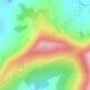
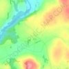
Pollerton Little topographic map

Click on the map to display elevation.

About this map

Name: Pollerton Little topographic map, elevation, terrain.

Location: Pollerton Little, Carlow Rural ED, The Municipal District of Carlow, County Carlow, Leinster, Ireland (52.84619 -6.90526 52.85690 -6.87496)

Average elevation: 240 ft

Minimum elevation: 177 ft

Maximum elevation: 331 ft

Other topographic maps

Click on a map to view its topography, its elevation and its terrain.
Greenoge

Ireland > County Carlow

Average elevation: 892 ft

Slievebawn

Ireland > County Carlow

Average elevation: 1,033 ft

Tinryland

Ireland > County Carlow

Average elevation: 236 ft

Ardattin

Ireland > County Carlow

Average elevation: 272 ft

Blackstairs Mountain

Ireland > County Carlow

Average elevation: 1,407 ft

Coolnamara Cross Roads

Ireland > County Carlow

Average elevation: 213 ft

Borris

Ireland > County Carlow

Average elevation: 197 ft

Borris

Ireland > County Carlow

Average elevation: 197 ft

Gear up for your next adventure:

🚁Photography Drones - Capture stunning aerial views of landforms and topography
🎒Trail Energy Bars - High‑calorie bars for hiking energy
🧭Outdoor Navigation Book - Learn advanced navigation skills
🌲Outdoor Survival Books - Best books on survival skills
🗃️Trail First Aid Kit - Essential kit for outdoor injuries and emergencies

As an Amazon Associate, this site earns from qualifying purchases at no extra cost to you.