Geolocate

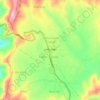
Jaboree topographic map

Click on the map to display elevation.

About this map

Name: Jaboree topographic map, elevation, terrain.

Location: Jaboree, Baffa Pakhal Tehsil, Mansehra District, Hazara Division, Khyber Pakhtunkhwa, Pakistan (34.58499 73.23907 34.62499 73.27907)

Average elevation: 5,282 ft

Minimum elevation: 4,111 ft

Maximum elevation: 7,028 ft

Other topographic maps

Click on a map to view its topography, its elevation and its terrain.
Mansehra

Pakistan > Khyber Pakhtunkhwa > Mānsehra District

Average elevation: 3,579 ft

Mansehra

Pakistan > Khyber Pakhtunkhwa > Mānsehra District

Average elevation: 3,579 ft

Kaghan

Pakistan > Khyber Pakhtunkhwa > Mānsehra District

Average elevation: 8,084 ft

Kaghan

Pakistan > Khyber Pakhtunkhwa > Mānsehra District

Average elevation: 8,084 ft

Mansehra

Pakistan > Khyber Pakhtunkhwa > Mānsehra District

Average elevation: 3,579 ft

Kaghan

Pakistan > Khyber Pakhtunkhwa > Mānsehra District

Average elevation: 8,084 ft

Gear up for your next adventure:

🛠️Outdoor Gear Repair Kit - Essential tools to fix gear on the trail
🏕️Family Camping Gear - Essentials for group camping trips
😴Insulated Sleeping Pads - Compact and warm pads for high-elevation camping
🌲Outdoor Survival Books - Best books on survival skills
👖Convertible Hiking Pants - Versatile zip-off pants for changing altitudes and temperatures

As an Amazon Associate, this site earns from qualifying purchases at no extra cost to you.