Geolocate

Heyworth topographic map

Click on the map to display elevation.

About this map

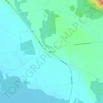
Name: Heyworth topographic map, elevation, terrain.

Location: Heyworth, Pontiac, Les Collines-de-l'Outaouais, Outaouais, Quebec, Canada (45.48055 -75.98320 45.52055 -75.94320)

Average elevation: 276 ft

Minimum elevation: 174 ft

Maximum elevation: 869 ft

Other topographic maps

Click on a map to view its topography, its elevation and its terrain.

Gear up for your next adventure:

🥾Men's Hiking Boots - Durable, waterproof footwear for rugged terrain and steep inclines
📡GPS Antenna Upgrade - Enhance GPS reception in remote terrain
🏕️Family Camping Gear - Essentials for group camping trips
🗃️Trail First Aid Kit - Essential kit for outdoor injuries and emergencies
🚁Photography Drones - Capture stunning aerial views of landforms and topography

As an Amazon Associate, this site earns from qualifying purchases at no extra cost to you.