Geolocate

Rolla topographic map

Click on the map to display elevation.

About this map

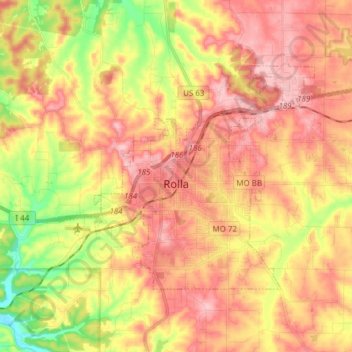
Name: Rolla topographic map, elevation, terrain.

Location: Rolla, Phelps County, Missouri, United States (37.91483 -91.82175 37.99211 -91.66948)

Average elevation: 1,017 ft

Minimum elevation: 735 ft

Maximum elevation: 1,217 ft

Phelps County trails, hiking, mountain biking, running and outdoor activities

Other topographic maps

Click on a map to view its topography, its elevation and its terrain.

Jerome

United States > Missouri > Phelps County

Average elevation: 797 ft

Gear up for your next adventure:

📌Outdoor GPS Map App - Apps and devices for digital topographic navigation
🦶Carbon Trekking Poles - Reduce knee impact on steep descents with ultra-light poles
🏕️Tent Footprint - Protect your tent base from wear
👟Trail Running Shoes - Lightweight shoes for trail runners
🛰️Satellite Messengers - Emergency SOS and two-way messaging for off-grid adventures

As an Amazon Associate, this site earns from qualifying purchases at no extra cost to you.