
Make a donation
Gear up for your next adventure:
As an Amazon Associate, this site earns from qualifying purchases at no extra cost to you.
Astrakhan topographic map
Click on the map to display elevation.
Make a donation
Gear up for your next adventure:
As an Amazon Associate, this site earns from qualifying purchases at no extra cost to you.
Astrakhan
Astrakhan (Russian: Астрахань, IPA: [ˈastrəxənʲ] ) is the largest city and administrative centre of Astrakhan Oblast in southern Russia. The city lies on two banks of the Volga, in the upper part of the Volga Delta, on eleven islands of the Caspian Depression, 60 miles (100 km) from the Caspian Sea, with a population of 475,629 residents at the 2021 Census. At an elevation of 28 meters (92 ft) below sea level, it is the lowest city in Russia.
Make a donation
Gear up for your next adventure:
As an Amazon Associate, this site earns from qualifying purchases at no extra cost to you.
About this map
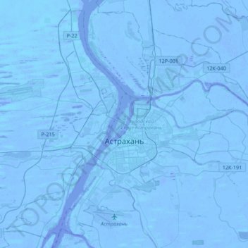
Name: Astrakhan topographic map, elevation, terrain.
Average elevation: -69 ft
Minimum elevation: -98 ft
Maximum elevation: -20 ft
Make a donation
Gear up for your next adventure:
As an Amazon Associate, this site earns from qualifying purchases at no extra cost to you.