Geolocate

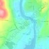
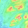
Fitz's Cross topographic map

Click on the map to display elevation.

About this map

Name: Fitz's Cross topographic map, elevation, terrain.

Location: Fitz's Cross, Killilagh ED, West Clare Municipal District, County Clare, Munster, V95 DE2X, Ireland (52.99600 -9.39760 53.03600 -9.35760)

Average elevation: 174 ft

Minimum elevation: 0 ft

Maximum elevation: 604 ft

Other topographic maps

Click on a map to view its topography, its elevation and its terrain.

Lahinch

Ireland > County Clare

Average elevation: 115 ft

Killaloe

Ireland > County Clare > Killaloe

Average elevation: 190 ft

Doonass

Ireland > County Clare

Average elevation: 92 ft

Kilfenora

Ireland > County Clare

Average elevation: 230 ft

Corofin

Ireland > County Clare

Average elevation: 79 ft

Clooney

Ireland > County Clare

Average elevation: 187 ft

Mountallon

Ireland > County Clare

Average elevation: 105 ft

Gear up for your next adventure:

📡GPS Antenna Upgrade - Enhance GPS reception in remote terrain
☕Camping Coffee Makers - Enjoy premium coffee at the summit or campsite
🔭Stargazing Telescopes - Perfect for camping in low-light pollution areas shown on maps
👟Trail Running Shoes - Lightweight shoes for trail runners
🎒Gear Packing Cubes - Organize your backpack efficiently

As an Amazon Associate, this site earns from qualifying purchases at no extra cost to you.