Geolocate

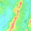
Westover topographic map

Click on the map to display elevation.

About this map
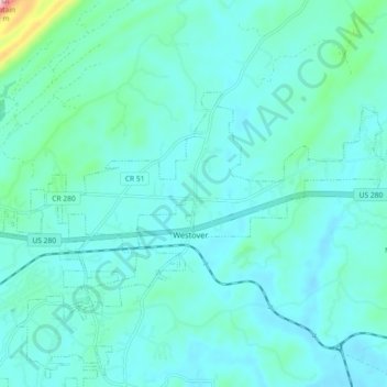
Name: Westover topographic map, elevation, terrain.

Location: Westover, Shelby County, Alabama, United States (33.30996 -86.58713 33.42235 -86.47822)

Average elevation: 581 ft

Minimum elevation: 413 ft

Maximum elevation: 1,506 ft

Shelby County trails, hiking, mountain biking, running and outdoor activities

Other topographic maps

Click on a map to view its topography, its elevation and its terrain.
Scottsdale

United States > Alabama > Shelby County > Alabaster

Average elevation: 551 ft

Valley Forge

United States > Alabama > Shelby County > Alabaster

Average elevation: 499 ft

Maylene

United States > Alabama > Shelby County > Alabaster

Average elevation: 587 ft

Meadowbrook

United States > Alabama > Shelby County

Average elevation: 630 ft

Chandalar South

United States > Alabama > Shelby County > Pelham

Average elevation: 525 ft

Abbot Springs

United States > Alabama > Shelby County > Westover

Average elevation: 535 ft

Lawley

United States > Alabama > Shelby County

Average elevation: 551 ft

Lake Purdy

United States > Alabama > Shelby County > Brook Highland

Average elevation: 614 ft

Indian Shoals

United States > Alabama > Shelby County > Wilsonville

Average elevation: 433 ft

Westover

United States > Alabama > Shelby County

Average elevation: 502 ft

Hardy

United States > Alabama > Shelby County > Alabaster

Average elevation: 515 ft

Meadowbrook

United States > Alabama > Shelby County > Meadowbrook

Average elevation: 630 ft

Gear up for your next adventure:

📷Action Camera - Capture your outdoor adventures in HD
📱Solar Portable Charger - Solar power bank for charging devices off‑grid
📶Satellite Messenger - Communication device off‑grid
🌐World Map Poster - Decorative world maps with topographic info
🧼Biodegradable Camping Soap - Eco‑friendly soap for outdoor hygiene

As an Amazon Associate, this site earns from qualifying purchases at no extra cost to you.