Geolocate

Moscow topographic map

Click on the map to display elevation.

About this map

Name: Moscow topographic map, elevation, terrain.

Location: Moscow, East Ayrshire, Scotland, KA4 8PN, United Kingdom (55.61296 -4.42477 55.65296 -4.38477)

Average elevation: 436 ft

Minimum elevation: 144 ft

Maximum elevation: 722 ft

Other topographic maps

Click on a map to view its topography, its elevation and its terrain.

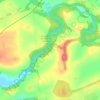
Braid Wood

United Kingdom > Scotland > East Ayrshire

Average elevation: 374 ft

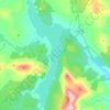
Glenbuck Loch

United Kingdom > Scotland > East Ayrshire

Average elevation: 1,073 ft

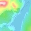
Loch Doon

United Kingdom > Scotland > East Ayrshire

Average elevation: 955 ft

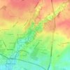
River Doon

United Kingdom > Scotland > East Ayrshire > Dalrymple

Average elevation: 551 ft

River Ayr

United Kingdom > Scotland > East Ayrshire

Average elevation: 689 ft

Fenwick Moor

United Kingdom > Scotland > East Ayrshire > Kingsford

Average elevation: 630 ft

Gear up for your next adventure:

🗺️NatGeo Topo Maps - High-quality waterproof printed topographic maps of US Parks
🦶Carbon Trekking Poles - Reduce knee impact on steep descents with ultra-light poles
🪶Thermal Camp Blanket - Extra warmth for cold nights
📱Solar Portable Charger - Solar power bank for charging devices off‑grid
🔦Compact Flashlight - Reliable flashlight for emergencies

As an Amazon Associate, this site earns from qualifying purchases at no extra cost to you.