
Thank you for supporting this site ❤️
Make a donation
Make a donation
Gear up for your next adventure:
As an Amazon Associate, this site earns from qualifying purchases at no extra cost to you.
Abensberg topographic map
Click on the map to display elevation.
Thank you for supporting this site ❤️
Make a donation
Make a donation
Gear up for your next adventure:
As an Amazon Associate, this site earns from qualifying purchases at no extra cost to you.
About this map
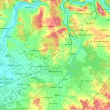
Name: Abensberg topographic map, elevation, terrain.
Location: Abensberg, Landkreis Kelheim, Bavaria, 93326, Germany (48.77434 11.79339 48.89409 11.92235)
Average elevation: 1,260 ft
Minimum elevation: 1,125 ft
Maximum elevation: 1,532 ft
Thank you for supporting this site ❤️
Make a donation
Make a donation
Gear up for your next adventure:
As an Amazon Associate, this site earns from qualifying purchases at no extra cost to you.