Geolocate

Proudfoot Point topographic map

Click on the map to display elevation.

About this map

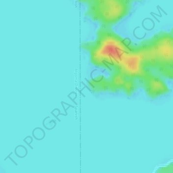
Name: Proudfoot Point topographic map, elevation, terrain.

Location: Proudfoot Point, Sables-Spanish Rivers Township, Sudbury District, Northeastern Ontario, Ontario, Canada (46.10126 -82.30996 46.10136 -82.30986)

Average elevation: 587 ft

Minimum elevation: 564 ft

Maximum elevation: 712 ft

Other topographic maps

Click on a map to view its topography, its elevation and its terrain.

Gear up for your next adventure:

🌡️Portable Weather Meter - Track weather conditions on the trail
🧤Tactile Hiking Gloves - Keep hands warm while operating GPS and smartphone screens
🦶Carbon Trekking Poles - Reduce knee impact on steep descents with ultra-light poles
🥄Camping Utensil Set - Lightweight utensils for outdoor meals
🧥Men's Rain Shells - Premium waterproof and breathable jackets for mountain weather

As an Amazon Associate, this site earns from qualifying purchases at no extra cost to you.