
Hammam Chott topographic map
Interactive map
Click on the map to display elevation.
About this map
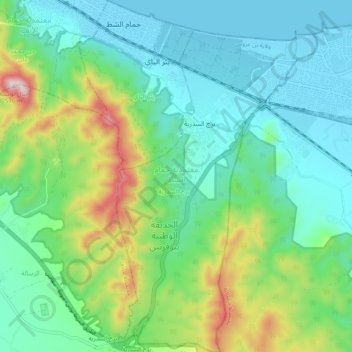
Name: Hammam Chott topographic map, elevation, terrain.
Location: Hammam Chott, Ben Arous, 2084, Tunisie (36.64482 10.35176 36.72419 10.41874)
Average elevation: 463 ft
Minimum elevation: -7 ft
Maximum elevation: 1,804 ft
Other topographic maps
Click on a map to view its topography, its elevation and its terrain.