Geolocate

洋渡镇 topographic map

Interactive map

Click on the map to display elevation.

About this map

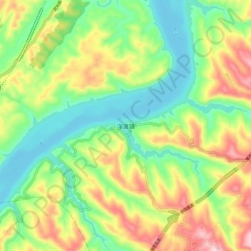
Name: 洋渡镇 topographic map, elevation, terrain.

Location: 洋渡镇, 忠县, 重庆市, 中国 (30.09070 107.88400 30.17070 107.96400)

Average elevation: 853 ft

Minimum elevation: 387 ft

Maximum elevation: 1,598 ft

Other topographic maps

Click on a map to view its topography, its elevation and its terrain.

金鸡镇

中国 > 重庆市 > 忠县

金鸡镇, 忠县, 重庆市, 中国

Average elevation: 1,900 ft

复兴镇

中国 > 重庆市 > 忠县

复兴镇, 忠县, 重庆市, 中国

Average elevation: 774 ft

马灌镇

中国 > 重庆市 > 忠县

马灌镇, 忠县, 重庆市, 中国

Average elevation: 1,601 ft

三峡水库

中国 > 重庆市 > 忠县

三峡水库, 忠县, 渝东北三峡库区城镇群, 重庆市, 中国

Average elevation: 2,566 ft

忠县

中国 > 重庆市 > 忠县

忠县, 渝东北三峡库区城镇群, 重庆市, 中国

Average elevation: 1,453 ft

忠州镇

中国 > 重庆市 > 忠县 > 忠州镇

忠州镇, 忠县, 渝东北三峡库区城镇群区位, 重庆市, 中国

Average elevation: 863 ft