Geolocate

Khyber topographic map

Click on the map to display elevation.

About this map

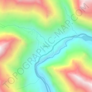
Name: Khyber topographic map, elevation, terrain.

Location: Khyber, Gilgit Division, Gilgit-Baltistan, Pakistan (36.55777 74.77611 36.59777 74.81611)

Average elevation: 10,505 ft

Minimum elevation: 8,596 ft

Maximum elevation: 13,330 ft

Other topographic maps

Click on a map to view its topography, its elevation and its terrain.

Astore Tehsil

Pakistan > Gilgit-Baltistan > Astore District

Average elevation: 12,454 ft

Astore District

Pakistan > Gilgit-Baltistan

Average elevation: 12,231 ft

Hunza District

Pakistan > Gilgit-Baltistan

Average elevation: 14,797 ft

Hunza River

Pakistan > Gilgit-Baltistan > Minapin Nagar

Average elevation: 8,855 ft

Shigar River

Pakistan > Gilgit-Baltistan > Skardu

Average elevation: 9,465 ft

Gear up for your next adventure:

👓Polarized Sunglasses - Outdoor sunglasses for glare reduction
📷Action Cameras - Rugged cameras to document your journeys across rugged terrain
👟Men's Trail Runners - Lightweight footwear for fast-paced exploration and light hiking
🧤Hiking Gloves - Protective gloves for rugged trails
📦Gear Storage Bags - Organize and protect outdoor equipment

As an Amazon Associate, this site earns from qualifying purchases at no extra cost to you.