
Camp Verde topographic map
Click on the map to display elevation.
About this map
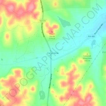
Name: Camp Verde topographic map, elevation, terrain.
Location: Camp Verde, Kerr County, Texas, 78010, United States (29.87386 -99.12464 29.91386 -99.08464)
Average elevation: 1,726 ft
Minimum elevation: 1,585 ft
Maximum elevation: 1,919 ft
Kerr County trails, hiking, mountain biking, running and outdoor activities
Other topographic maps
Click on a map to view its topography, its elevation and its terrain.
Kerrville
United States > Texas > Kerr County
Kerrville is characterized by a diverse and rugged topography. Nestled along the Guadalupe River, it sits at an elevation averaging 1,600 feet above sea level, with varying terrain that includes gentle hills, steep slopes, and flat river valleys. This area features numerous limestone hills, characteristic of…
Average elevation: 1,788 ft