Geolocate

Red Springs topographic map

Click on the map to display elevation.

About this map

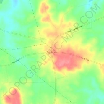
Name: Red Springs topographic map, elevation, terrain.

Location: Red Springs, Smith County, Texas, United States (32.51209 -95.29078 32.55209 -95.25078)

Average elevation: 440 ft

Minimum elevation: 318 ft

Maximum elevation: 581 ft

Smith County trails, hiking, mountain biking, running and outdoor activities

Other topographic maps

Click on a map to view its topography, its elevation and its terrain.

Winona

United States > Texas > Smith County > Winona

Average elevation: 377 ft

Noonday

United States > Texas > Smith County

Average elevation: 469 ft

Tyler

United States > Texas > Smith County

Average elevation: 482 ft

Lake Tyler

United States > Texas > Smith County

Average elevation: 423 ft

Winona

United States > Texas > Smith County

Average elevation: 390 ft

New Chapel Hill

United States > Texas > Smith County

Average elevation: 453 ft

Arp

United States > Texas > Smith County

Average elevation: 502 ft

Whitehouse

United States > Texas > Smith County

Average elevation: 466 ft

Gear up for your next adventure:

🪄Magnetic Compass - Accurate compass for navigation
🛠️Outdoor Gear Repair Kit - Essential tools to fix gear on the trail
🪑Ultralight Camp Chairs - Portable seating for resting after a long day of mapping
GPS Sports Watch - GPS watch for running, hiking and training
🧭Compass with Lanyard - Easy‑carry compass for navigation

As an Amazon Associate, this site earns from qualifying purchases at no extra cost to you.