
Make a donation
Gear up for your next adventure:
As an Amazon Associate, this site earns from qualifying purchases at no extra cost to you.
Neapoli Municipal Unit topographic map
Click on the map to display elevation.
Make a donation
Gear up for your next adventure:
As an Amazon Associate, this site earns from qualifying purchases at no extra cost to you.
About this map
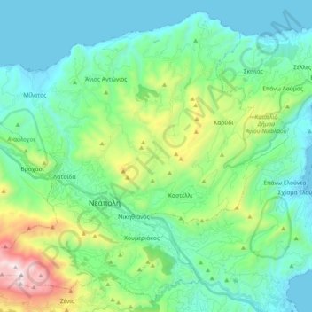
Name: Neapoli Municipal Unit topographic map, elevation, terrain.
Average elevation: 1,089 ft
Minimum elevation: -3 ft
Maximum elevation: 4,846 ft
Make a donation
Gear up for your next adventure:
As an Amazon Associate, this site earns from qualifying purchases at no extra cost to you.
Other topographic maps
Click on a map to view its topography, its elevation and its terrain.
Agia Fotia
Greece > Region of Crete > Lasithi Regional Unit > Sitia Municipal Unit
Average elevation: 459 ft
Palaikastro
Greece > Region of Crete > Lasithi Regional Unit > Itanos Municipal Unit
Average elevation: 249 ft
Agios Andreas
Greece > Region of Crete > Lasithi Regional Unit > Sitia Municipal Unit
Average elevation: 302 ft
Krioneri
Greece > Region of Crete > Lasithi Regional Unit > Itanos Municipal Unit
Average elevation: 1,883 ft
Make a donation
Gear up for your next adventure:
As an Amazon Associate, this site earns from qualifying purchases at no extra cost to you.
Kritsa
Greece > Region of Crete > Lasithi Regional Unit > Agios Nikolaos Municipal Unit
Kritsa (Greek: Κριτσά, romanized: Critsá) is one of the oldest and most picturesque villages in Crete, Greece, built amphitheatrically on a rock hill, named Kastellos, surrounded by olive groves, at an altitude of 375 m. It is part of the municipality of Agios Nikolaos. During the Middle Ages, it was…
Average elevation: 1,463 ft
Anemomilia
Greece > Region of Crete > Lasithi Regional Unit > Sitia Municipal Unit
Average elevation: 177 ft