Geolocate

Kijabe topographic map

Click on the map to display elevation.

About this map

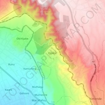
Name: Kijabe topographic map, elevation, terrain.

Location: Kijabe, Kijabe ward, Lari, Kiambu, Central Kenya, 00221, Kenya (-0.98633 36.55602 -0.90633 36.63602)

Average elevation: 7,326 ft

Minimum elevation: 5,932 ft

Maximum elevation: 8,724 ft

Gear up for your next adventure:

🛡️Insect Repellent - Protection against bugs during outdoor activities
👟Trail Running Shoes - Lightweight shoes for trail runners
🔌Solar Panel Charger - Charge gear sustainably outdoors
🥘Titanium Cookware - Durable, featherlight pots and pans for backpacking
🛰️Satellite Messengers - Emergency SOS and two-way messaging for off-grid adventures

As an Amazon Associate, this site earns from qualifying purchases at no extra cost to you.