
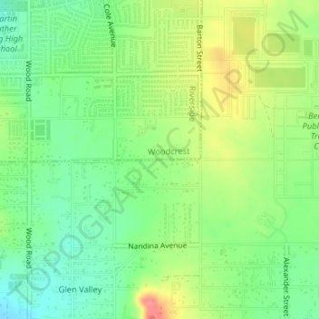
Woodcrest topographic map
Click on the map to display elevation.
About this map
Name: Woodcrest topographic map, elevation, terrain.
Average elevation: 1,699 ft
Minimum elevation: 1,591 ft
Maximum elevation: 1,860 ft
Riverside County trails, hiking, mountain biking, running and outdoor activities
Other topographic maps
Click on a map to view its topography, its elevation and its terrain.
Arlington Station
United States > California > Riverside County > Riverside
Arlington Station (formerly, Arlington) is a former unincorporated community, now annexed to Riverside in Riverside County, California. It lies at an elevation of 817 feet (249 m). Arlington Station is located on the Atchison, Topeka and Santa Fe Railroad, 6 miles (9.7 km) southwest of downtown Riverside.
Average elevation: 827 ft
Bannockburn Village
United States > California > Riverside County > Riverside > Bannockburn Village
Average elevation: 1,102 ft