Geolocate

Modera topographic map

Interactive map

Click on the map to display elevation.

About this map

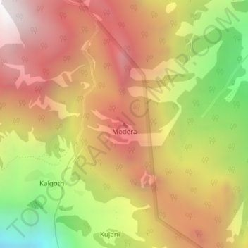
Name: Modera topographic map, elevation, terrain.

Location: Modera, Joshimath Tehsil, Chamoli District, Uttarakhand, India (30.52291 79.42418 30.52301 79.42428)

Average elevation: 9,452 ft

Minimum elevation: 6,266 ft

Maximum elevation: 11,860 ft

Other topographic maps

Click on a map to view its topography, its elevation and its terrain.

Mana

India > Uttarakhand > Joshimath Tehsil

Mana, Joshimath Tehsil, Chamoli District, Uttarakhand, India

Average elevation: 16,270 ft

Badrinath

India > Uttarakhand > Joshimath Tehsil > Badrinath

Badrinath, Joshimath Tehsil, Chamoli district, Uttarakhand, India

Average elevation: 13,294 ft

Nanda Devi

India > Uttarakhand > Joshimath Tehsil

Nanda Devi, Joshimath Tehsil, Chamoli district, Uttarakhand, India

Average elevation: 21,545 ft