Geolocate

Boynton topographic map

Interactive map

Click on the map to display elevation.

About this map

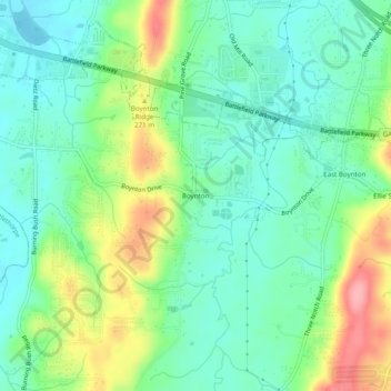
Name: Boynton topographic map, elevation, terrain.

Location: Boynton, Catoosa County, Georgia, 30736, United States (34.90341 -85.21079 34.94341 -85.17079)

Average elevation: 784 ft

Minimum elevation: 666 ft

Maximum elevation: 1,033 ft

Other topographic maps

Click on a map to view its topography, its elevation and its terrain.

Lakeview

United States > Georgia > Catoosa County > Fort Oglethorpe

Lakeview, Fort Oglethorpe, Catoosa County, Georgia, United States

Average elevation: 778 ft

Indian Springs

United States > Georgia > Catoosa County

Indian Springs, Catoosa County, Georgia, United States

Average elevation: 774 ft

Ringgold

United States > Georgia > Catoosa County

Ringgold, Catoosa County, Georgia, United States

Average elevation: 879 ft

Blue Spring

United States > Georgia > Catoosa County

Blue Spring, Catoosa County, Georgia, United States, Blue Spring Lake

Average elevation: 774 ft

Cloud Springs

United States > Georgia > Catoosa County > Fort Oglethorpe

Cloud Springs, Fort Oglethorpe, Catoosa County, Georgia, 30742, United States

Average elevation: 778 ft

Fort Oglethorpe

United States > Georgia > Catoosa County

Fort Oglethorpe, Catoosa County, Georgia, 30742, United States

Average elevation: 774 ft