
Make a donation
Gear up for your next adventure:
As an Amazon Associate, this site earns from qualifying purchases at no extra cost to you.
Indian Springs topographic map
Click on the map to display elevation.
Make a donation
Gear up for your next adventure:
As an Amazon Associate, this site earns from qualifying purchases at no extra cost to you.
About this map
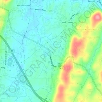
Name: Indian Springs topographic map, elevation, terrain.
Location: Indian Springs, Catoosa County, Georgia, United States (34.94135 -85.18172 34.97698 -85.13672)
Average elevation: 774 ft
Minimum elevation: 669 ft
Maximum elevation: 1,047 ft
Catoosa County trails, hiking, mountain biking, running and outdoor activities
Make a donation
Gear up for your next adventure:
As an Amazon Associate, this site earns from qualifying purchases at no extra cost to you.
Other topographic maps
Click on a map to view its topography, its elevation and its terrain.
Chickamauga and Chattanooga National Military Park
United States > Georgia > Catoosa County > Fort Oglethorpe
Average elevation: 755 ft
Make a donation
Gear up for your next adventure:
As an Amazon Associate, this site earns from qualifying purchases at no extra cost to you.