
Make a donation
Gear up for your next adventure:
As an Amazon Associate, this site earns from qualifying purchases at no extra cost to you.
Thousand Springs topographic map
Click on the map to display elevation.
Make a donation
Gear up for your next adventure:
As an Amazon Associate, this site earns from qualifying purchases at no extra cost to you.
About this map
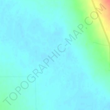
Name: Thousand Springs topographic map, elevation, terrain.
Location: Thousand Springs, Custer County, Idaho, United States (44.13709 -113.92342 44.13719 -113.92332)
Average elevation: 6,306 ft
Minimum elevation: 6,280 ft
Maximum elevation: 6,444 ft
Custer County trails, hiking, mountain biking, running and outdoor activities
Make a donation
Gear up for your next adventure:
As an Amazon Associate, this site earns from qualifying purchases at no extra cost to you.
Other topographic maps
Click on a map to view its topography, its elevation and its terrain.
Clayton
United States > Idaho > Custer County
Clayton is located at 44°15′32″N 114°23′59″W / 44.25889°N 114.39972°W / 44.25889; -114.39972 (44.259014, -114.399725), at an elevation of 5,489 feet (1,673 m) above sea level.
Average elevation: 6,447 ft
Stanley Lake
United States > Idaho > Custer County
The lake is approximately seven miles (11 km) west of Stanley, readily accessed via a three-mile (5 km) spur road from State Highway 21. The surface elevation of the lake is 6,513 feet (1,985 m) above sea level.
Average elevation: 6,808 ft