Geolocate

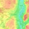
Redzikowo topographic map

Click on the map to display elevation.

About this map

Name: Redzikowo topographic map, elevation, terrain.

Location: Redzikowo, gmina Redzikowo, Słupsk County, Pomeranian Voivodeship, Poland (54.45277 17.07875 54.48917 17.16368)

Average elevation: 203 ft

Minimum elevation: 95 ft

Maximum elevation: 266 ft

Other topographic maps

Click on a map to view its topography, its elevation and its terrain.

Kobylnica

Poland > Pomeranian Voivodeship > Słupsk County

Average elevation: 148 ft

Gear up for your next adventure:

🪶Camp Gear Gift Set - Perfect gift bundle for outdoor fans
⛺Backpacking Tent - Lightweight and durable tent for multi‑day hikes
🔌USB Car Charger - Car charger for on‑the‑go power needs
🪄Magnetic Compass - Accurate compass for navigation
🔭Stargazing Telescopes - Perfect for camping in low-light pollution areas shown on maps

As an Amazon Associate, this site earns from qualifying purchases at no extra cost to you.