Geolocate

Pobłocie topographic map

Click on the map to display elevation.

About this map
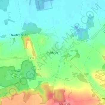
Name: Pobłocie topographic map, elevation, terrain.

Location: Pobłocie, gmina Główczyce, Słupsk County, Pomeranian Voivodeship, 76-220, Poland (54.61248 17.48427 54.65248 17.52427)

Average elevation: 75 ft

Minimum elevation: -3 ft

Maximum elevation: 246 ft

Other topographic maps

Click on a map to view its topography, its elevation and its terrain.

Kępice

Poland > Pomeranian Voivodeship > Słupsk County

Average elevation: 220 ft

Redzikowo

Poland > Pomeranian Voivodeship > Słupsk County

Average elevation: 203 ft

Ustka

Poland > Pomeranian Voivodeship > Słupsk County

Average elevation: 20 ft

Gear up for your next adventure:

🌧️Backpack Rain Cover - Keep gear dry in wet weather
🌄Hiking Binoculars - Compact binoculars for scenic views and trail spotting
🔦Compact Flashlight - Reliable flashlight for emergencies
📡Handheld GPS Device - Reliable handheld GPS for outdoor navigation
🧥Men's Rain Shells - Premium waterproof and breathable jackets for mountain weather

As an Amazon Associate, this site earns from qualifying purchases at no extra cost to you.