Geolocate

Hackett topographic map

Click on the map to display elevation.

👉 Easily get elevation data in JSON, GeoTIFF and KML formats using Elevation API
Thank you for supporting this site ❤️
Make a donation

About this map

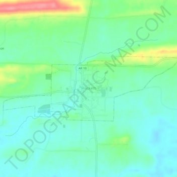
Name: Hackett topographic map, elevation, terrain.

Location: Hackett, Sebastian County, Arkansas, United States (35.17996 -94.43594 35.19484 -94.38618)

Average elevation: 548 ft

Minimum elevation: 469 ft

Maximum elevation: 761 ft

Sebastian County trails, hiking, mountain biking, running and outdoor activities

Other topographic maps

Click on a map to view its topography, its elevation and its terrain.

Fort Smith

United States > Arkansas > Sebastian County > Fort Smith

Average elevation: 535 ft

Old Jenny Lind

United States > Arkansas > Sebastian County

Average elevation: 551 ft

Gear up for your next adventure:

🧤Tactile Hiking Gloves - Keep hands warm while operating GPS and smartphone screens
🛡️Insect Repellent - Protection against bugs during outdoor activities
🥾Women's Hiking Boots - Top-rated trail boots with ankle support and superior grip
🗺️NatGeo Topo Maps - High-quality waterproof printed topographic maps of US Parks
🪶Fire Starter Kit - Reliable fire starter for survival and camping

As an Amazon Associate, this site earns from qualifying purchases at no extra cost to you.