Geolocate

Butler topographic map

Click on the map to display elevation.

About this map

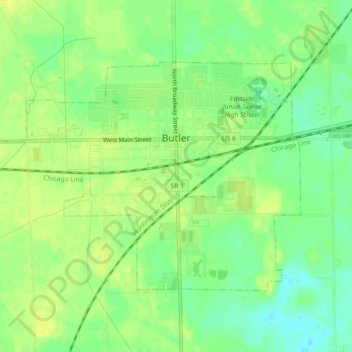
Name: Butler topographic map, elevation, terrain.

Location: Butler, DeKalb County, Indiana, United States (41.41513 -84.90039 41.43707 -84.85544)

Average elevation: 869 ft

Minimum elevation: 833 ft

Maximum elevation: 889 ft

DeKalb County trails, hiking, mountain biking, running and outdoor activities

Other topographic maps

Click on a map to view its topography, its elevation and its terrain.

Spencerville

United States > Indiana > DeKalb County

Average elevation: 817 ft

Stafford Center

United States > Indiana > DeKalb County

Average elevation: 846 ft

Gear up for your next adventure:

🌲Outdoor Survival Books - Best books on survival skills
😴Insulated Sleeping Pads - Compact and warm pads for high-elevation camping
🪶Camping Sleeping Pad - Comfortable sleeping pad for backpacking
🚪Portable Camp Chair - Foldable chair for comfort at camp
🥤Water Filter Bottle - All‑in‑one filter bottle for safe hydration

As an Amazon Associate, this site earns from qualifying purchases at no extra cost to you.