Geolocate

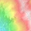
Beaune topographic map

Click on the map to display elevation.

About this map

Name: Beaune topographic map, elevation, terrain.

Location: Beaune, Saint-Michel-de-Maurienne, Saint-Jean-de-Maurienne, Savoie, Auvergne-Rhône-Alpes, France métropolitaine, 73140, France (45.22998 6.45316 45.26998 6.49316)

Average elevation: 5,010 ft

Minimum elevation: 2,244 ft

Maximum elevation: 8,163 ft

Other topographic maps

Click on a map to view its topography, its elevation and its terrain.
Gear up for your next adventure:

🏫Relief Map Kits - Hands-on tools for teaching landforms and elevation
🥇GPS Hiking Watch - Multi‑sport GPS watch with navigation and trail tracking
🧣Merino Neck Gaiters - Multi-functional headwear for wind and sun protection
❄️Traction Cleats - Prevent slips on icy trails during winter hikes
🛡️Bear Spray Outdoor - Protection in bear country hikes

As an Amazon Associate, this site earns from qualifying purchases at no extra cost to you.