Geolocate

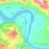
Shaindhel topographic map

Click on the map to display elevation.

About this map

Name: Shaindhel topographic map, elevation, terrain.

Location: Shaindhel, Karsog, Mandi, Himachal Pradesh, India (31.29913 77.20039 31.33913 77.24039)

Average elevation: 4,931 ft

Minimum elevation: 3,353 ft

Maximum elevation: 6,860 ft

Other topographic maps

Click on a map to view its topography, its elevation and its terrain.
Bitahli Khad

India > Himachal Pradesh > Karsog

Average elevation: 4,695 ft

Sunni

India > Himachal Pradesh > Karsog

Average elevation: 2,520 ft

Sunni

India > Himachal Pradesh > Karsog

Average elevation: 2,520 ft

Gear up for your next adventure:

🦺Reflective Outdoor Gear - Safety gear for low‑light conditions
🎒Waterproof Dry Bags - Keep your electronics and maps dry inside your pack
🌲Outdoor Survival Books - Best books on survival skills
❄️Traction Cleats - Prevent slips on icy trails during winter hikes
📱Heavy-Duty Phone Cases - Drop-proof and waterproof protection for outdoor navigation

As an Amazon Associate, this site earns from qualifying purchases at no extra cost to you.