Geolocate

Sasa topographic map

Click on the map to display elevation.

About this map

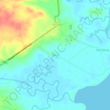
Name: Sasa topographic map, elevation, terrain.

Location: Sasa, Surigao del Sur, Caraga, 8310, Philippines (8.34992 126.29120 8.38992 126.33120)

Average elevation: 52 ft

Minimum elevation: -3 ft

Maximum elevation: 210 ft

Other topographic maps

Click on a map to view its topography, its elevation and its terrain.

Bayabas

Philippines > Surigao del Sur

Average elevation: 115 ft

Hinatuan

Philippines > Surigao del Sur

Average elevation: 98 ft

Vanishing Island

Philippines > Surigao del Sur

Average elevation: 0 ft

Lingig

Philippines > Surigao del Sur

Average elevation: 230 ft

Bislig

Philippines > Surigao del Sur

Average elevation: 233 ft

Carac-an River

Philippines > Surigao del Sur > Cancavan

Average elevation: 75 ft

Sua Island

Philippines > Surigao del Sur > Unidad

Average elevation: 69 ft

Lingig

Philippines > Surigao del Sur

Average elevation: 230 ft

Hinatuan

Philippines > Surigao del Sur

Average elevation: 98 ft

Hinatuan

Philippines > Surigao del Sur

Average elevation: 98 ft

Bislig

Philippines > Surigao del Sur

Average elevation: 233 ft

Gear up for your next adventure:

🪓Survival Multi‑Tool - Versatile tool for camp and trail tasks
🪶LED Camping Lantern - Bright lantern for camp lighting
🔊Portable Camp Speaker - Music and alerts at camp
🧦Hiking Socks - Comfortable socks to prevent blisters on long hikes
🎒Outdoor Daypacks - Lightweight backpacks designed for carrying maps and essential gear

As an Amazon Associate, this site earns from qualifying purchases at no extra cost to you.