
Thank you for supporting this site ❤️
Make a donation
Make a donation
Gear up for your next adventure:
As an Amazon Associate, this site earns from qualifying purchases at no extra cost to you.
Arkhale topographic map
Click on the map to display elevation.
Thank you for supporting this site ❤️
Make a donation
Make a donation
Gear up for your next adventure:
As an Amazon Associate, this site earns from qualifying purchases at no extra cost to you.
About this map
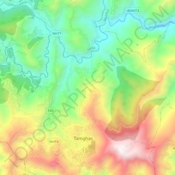
Name: Arkhale topographic map, elevation, terrain.
Location: Arkhale, Resunga, Gulmi, Lumbini Province, Nepal (28.06638 83.20107 28.11545 83.28777)
Average elevation: 4,347 ft
Minimum elevation: 2,280 ft
Maximum elevation: 7,585 ft
Thank you for supporting this site ❤️
Make a donation
Make a donation
Gear up for your next adventure:
As an Amazon Associate, this site earns from qualifying purchases at no extra cost to you.