Geolocate

Greendale topographic map

Click on the map to display elevation.

About this map

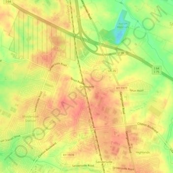
Name: Greendale topographic map, elevation, terrain.

Location: Greendale, Lexington, Fayette County, Kentucky, 40511, United States (38.08501 -84.54477 38.12501 -84.50477)

Average elevation: 932 ft

Minimum elevation: 817 ft

Maximum elevation: 994 ft

Other topographic maps

Click on a map to view its topography, its elevation and its terrain.

Meadowthorpe

United States > Kentucky > Fayette County > Lexington

Average elevation: 951 ft

Griffin Gate

United States > Kentucky > Fayette County > Lexington

Average elevation: 955 ft

Veterans Park

United States > Kentucky > Fayette County > Lexington

Average elevation: 945 ft

Gardenside

United States > Kentucky > Fayette County > Lexington

Average elevation: 958 ft

Stoneybrook

United States > Kentucky > Fayette County > Lexington

Average elevation: 1,001 ft

Winburn

United States > Kentucky > Fayette County > Lexington

Average elevation: 958 ft

Shillito Park

United States > Kentucky > Fayette County > Lexington

Average elevation: 1,007 ft

Beaumont

United States > Kentucky > Fayette County > Lexington

Average elevation: 981 ft

Gear up for your next adventure:

🌡️Handheld Weather Meters - Measure wind, temp, and pressure for safe mountain travel
🗃️Trail First Aid Kit - Essential kit for outdoor injuries and emergencies
🎒Day Hiking Backpack - Lightweight backpack perfect for day trips and outdoor adventures
📷Action Camera - Capture your outdoor adventures in HD
🔌Solar Panel Charger - Charge gear sustainably outdoors

As an Amazon Associate, this site earns from qualifying purchases at no extra cost to you.