Geolocate

Griffin Gate topographic map

Click on the map to display elevation.

About this map

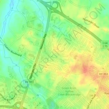
Name: Griffin Gate topographic map, elevation, terrain.

Location: Griffin Gate, Lexington, Fayette County, Kentucky, United States (38.08247 -84.48907 38.09355 -84.47869)

Average elevation: 955 ft

Minimum elevation: 883 ft

Maximum elevation: 1,020 ft

Fayette County trails, hiking, mountain biking, running and outdoor activities

Other topographic maps

Click on a map to view its topography, its elevation and its terrain.

Gainesway

United States > Kentucky > Fayette County > Lexington

Average elevation: 988 ft

Chevy Chase

United States > Kentucky > Fayette County > Lexington

Average elevation: 1,017 ft

Gratz Park

United States > Kentucky > Fayette County > Lexington

Average elevation: 981 ft

Bryan Station

United States > Kentucky > Fayette County > Lexington

Average elevation: 948 ft

Walnut Hill

United States > Kentucky > Fayette County > Lexington

Average elevation: 1,020 ft

Northland

United States > Kentucky > Fayette County > Lexington > Northland

Average elevation: 981 ft

Gear up for your next adventure:

📷Action Cameras - Rugged cameras to document your journeys across rugged terrain
🎒Outdoor Daypacks - Lightweight backpacks designed for carrying maps and essential gear
🎁Geography Themed Gifts - Unique gift ideas for map lovers and geography enthusiasts
🔥Plasma Lighters - Windproof lighters that work in any weather condition
🧣Hiking Neck Gaiter - Multi‑use neck protection for outdoor weather

As an Amazon Associate, this site earns from qualifying purchases at no extra cost to you.