
Pano topographic map
Interactive map
Click on the map to display elevation.
About this map
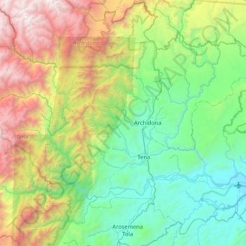
Name: Pano topographic map, elevation, terrain.
Location: Pano, Tena, Napo, Ecuador (-1.06349 -78.42726 -0.75604 -77.83652)
Average elevation: 4,757 ft
Minimum elevation: 1,165 ft
Maximum elevation: 14,029 ft
Other topographic maps
Click on a map to view its topography, its elevation and its terrain.
San José de Chonta Punta
San José de Chonta Punta, Chonta Punta, Tena, Napo, Ecuador
Average elevation: 1,037 ft
Puerto Misahuallí
Puerto Misahuallí, Tena, Napo, Ecuador
Average elevation: 2,228 ft