
Talag topographic map
Interactive map
Click on the map to display elevation.
About this map
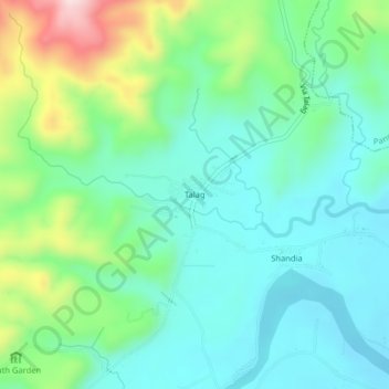
Name: Talag topographic map, elevation, terrain.
Location: Talag, Tálag, Tena, Napo, Ecuador (-1.08503 -77.92708 -1.04503 -77.88708)
Average elevation: 1,919 ft
Minimum elevation: 1,591 ft
Maximum elevation: 2,825 ft
Other topographic maps
Click on a map to view its topography, its elevation and its terrain.
San José de Chonta Punta
San José de Chonta Punta, Chonta Punta, Tena, Napo, Ecuador
Average elevation: 1,037 ft
Puerto Misahuallí
Puerto Misahuallí, Tena, Napo, Ecuador
Average elevation: 2,228 ft