
Puerto Napo topographic map
Interactive map
Click on the map to display elevation.
About this map
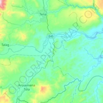
Name: Puerto Napo topographic map, elevation, terrain.
Location: Puerto Napo, Tena, Napo, Ecuador (-1.17679 -77.86108 -0.98714 -77.61256)
Average elevation: 1,854 ft
Minimum elevation: 1,270 ft
Maximum elevation: 4,616 ft
Other topographic maps
Click on a map to view its topography, its elevation and its terrain.
San José de Chonta Punta
San José de Chonta Punta, Chonta Punta, Tena, Napo, Ecuador
Average elevation: 1,037 ft
Puerto Misahuallí
Puerto Misahuallí, Tena, Napo, Ecuador
Average elevation: 2,228 ft