Geolocate

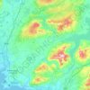
Corkscrew Hill topographic map

Click on the map to display elevation.

About this map

Name: Corkscrew Hill topographic map, elevation, terrain.

Location: Corkscrew Hill, Rathborney ED, West Clare Municipal District, County Clare, Munster, H91 CF60, Ireland (53.06123 -9.19830 53.08123 -9.17830)

Average elevation: 551 ft

Minimum elevation: 75 ft

Maximum elevation: 896 ft

Other topographic maps

Click on a map to view its topography, its elevation and its terrain.

Lahinch

Ireland > County Clare

Average elevation: 115 ft

Killaloe

Ireland > County Clare > Killaloe

Average elevation: 190 ft

Doonass

Ireland > County Clare

Average elevation: 92 ft

Kilfenora

Ireland > County Clare

Average elevation: 230 ft

Corofin

Ireland > County Clare

Average elevation: 79 ft

Clooney

Ireland > County Clare

Average elevation: 187 ft

Mountallon

Ireland > County Clare

Average elevation: 105 ft

Gear up for your next adventure:

🥩Freeze-Dried Meals - Nutritious and lightweight food for remote expeditions
☀️Outdoor Sunscreen - High protection sunscreen for outdoor activities
📻Weather Alert Radios - Stay informed of storm risks while off-the-grid
🔦LED Headlamp - Bright and durable LED headlamp for night navigation
🏕️Family Camping Gear - Essentials for group camping trips

As an Amazon Associate, this site earns from qualifying purchases at no extra cost to you.