
Sumas River topographic map
Click on the map to display elevation.
About this map
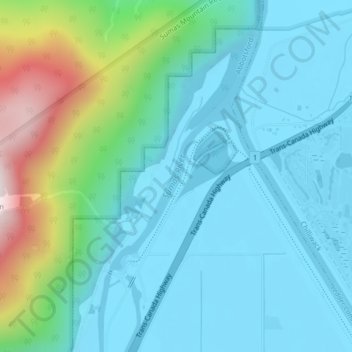
Name: Sumas River topographic map, elevation, terrain.
Average elevation: 548 ft
Minimum elevation: -7 ft
Maximum elevation: 2,726 ft
Other topographic maps
Click on a map to view its topography, its elevation and its terrain.
Stoney Creek Park
Canada > British Columbia > Fraser Valley Regional District > Abbotsford
Average elevation: 131 ft
Abbotsford
Canada > British Columbia > Fraser Valley Regional District > Abbotsford
Average elevation: 377 ft
Sumas Prairie
Canada > British Columbia > Fraser Valley Regional District > Abbotsford
Average elevation: 522 ft
Eagle Mountain
Canada > British Columbia > Fraser Valley Regional District > Abbotsford
Average elevation: 420 ft
Sumas Prairie
Canada > British Columbia > Fraser Valley Regional District > Abbotsford
Average elevation: 522 ft