
Ioco topographic map
Click on the map to display elevation.
About this map
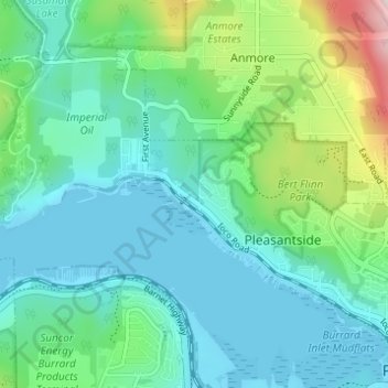
Name: Ioco topographic map, elevation, terrain.
Average elevation: 318 ft
Minimum elevation: -3 ft
Maximum elevation: 1,503 ft
Other topographic maps
Click on a map to view its topography, its elevation and its terrain.
White Pine Beach
Canada > British Columbia > Metro Vancouver Regional District > Port Moody
Average elevation: 410 ft
Belcarra Regional Park
Canada > British Columbia > Metro Vancouver Regional District > Port Moody
Average elevation: 236 ft