Geolocate

Creggan topographic map

Click on the map to display elevation.

About this map

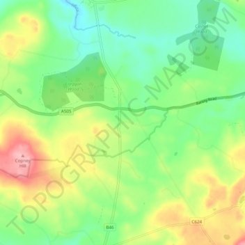
Name: Creggan topographic map, elevation, terrain.

Location: Creggan, County Tyrone, Ulster, Northern Ireland, BT79 9AF, United Kingdom (54.62633 -7.06530 54.67131 -6.96933)

Average elevation: 623 ft

Minimum elevation: 449 ft

Maximum elevation: 906 ft

Other topographic maps

Click on a map to view its topography, its elevation and its terrain.

Mullaghcarn

United Kingdom > Northern Ireland > County Tyrone

Average elevation: 1,266 ft

Augher

United Kingdom > Northern Ireland > County Tyrone

Average elevation: 240 ft

Bready

United Kingdom > Northern Ireland > County Tyrone

Average elevation: 118 ft

Coagh

United Kingdom > Northern Ireland > County Tyrone

Average elevation: 141 ft

Dromore

United Kingdom > Northern Ireland > County Tyrone

Average elevation: 371 ft

Strabane

United Kingdom > Northern Ireland > County Tyrone

Average elevation: 233 ft

Clady

United Kingdom > Northern Ireland > County Tyrone

Average elevation: 151 ft

Killeter

United Kingdom > Northern Ireland > County Tyrone

Average elevation: 404 ft

Eglish

United Kingdom > Northern Ireland > County Tyrone

Average elevation: 640 ft

Trillick

United Kingdom > Northern Ireland > County Tyrone

Average elevation: 427 ft

Fintona

United Kingdom > Northern Ireland > County Tyrone

Average elevation: 387 ft

Benburb

United Kingdom > Northern Ireland > County Tyrone

Average elevation: 148 ft

Laghey

United Kingdom > Northern Ireland > County Tyrone

Average elevation: 118 ft

Ardboe

United Kingdom > Northern Ireland > County Tyrone

Average elevation: 52 ft

Craig

United Kingdom > Northern Ireland > County Tyrone

Average elevation: 758 ft

Ardstraw

United Kingdom > Northern Ireland > County Tyrone

Average elevation: 233 ft

Newmills

United Kingdom > Northern Ireland > County Tyrone

Average elevation: 253 ft

Galbally

United Kingdom > Northern Ireland > County Tyrone

Average elevation: 390 ft

Ardstraw

United Kingdom > Northern Ireland > County Tyrone

Average elevation: 233 ft

Gear up for your next adventure:

🛠️Outdoor Gear Repair Kit - Essential tools to fix gear on the trail
📷Action Cameras - Rugged cameras to document your journeys across rugged terrain
🥾Men's Hiking Boots - Durable, waterproof footwear for rugged terrain and steep inclines
Backpacking Tent - Lightweight and durable tent for multi‑day hikes
🔦Compact Flashlight - Reliable flashlight for emergencies

As an Amazon Associate, this site earns from qualifying purchases at no extra cost to you.