
Make a donation
Gear up for your next adventure:
As an Amazon Associate, this site earns from qualifying purchases at no extra cost to you.
Cholmondeston topographic map
Click on the map to display elevation.
Make a donation
Gear up for your next adventure:
As an Amazon Associate, this site earns from qualifying purchases at no extra cost to you.
Cholmondeston
The civil parish has a total area of 1,749 acres (708 ha).[17] The terrain is predominantly flat, with an average elevation of around 50 metres. A trig point is located at SJ631567, at an elevation of 55 metres. Crowton Brook runs north–south through the civil parish and Bankside Brook forms part of the northern boundary; there are numerous scattered small meres and ponds. Several small areas of woodland are located within the civil parish. The small village of Cholmondeston (SJ628599) lies in the north of the civil parish at the junction between Winsford Road, Minshull Lane and Calveley Green Lane.[18] The area is predominantly rural, with the major land use being agricultural.[19]
Make a donation
Gear up for your next adventure:
As an Amazon Associate, this site earns from qualifying purchases at no extra cost to you.
About this map
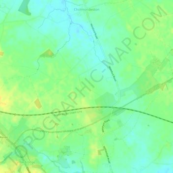
Name: Cholmondeston topographic map, elevation, terrain.
Location: Cholmondeston, Cheshire East, England, United Kingdom (53.10299 -2.57477 53.13714 -2.52158)
Average elevation: 157 ft
Minimum elevation: 125 ft
Maximum elevation: 197 ft
Make a donation
Gear up for your next adventure:
As an Amazon Associate, this site earns from qualifying purchases at no extra cost to you.
Other topographic maps
Click on a map to view its topography, its elevation and its terrain.
Bickerton Hill
United Kingdom > England > Cheshire East > Bickerton
Bickerton Hill refers to two low red sandstone hills that form the southern end of the Mid Cheshire Ridge in Cheshire, north-west England. The high point, Raw Head, lies on the northerly hill and has an elevation of 227 metres. Parts of the southerly hill are also known as Larkton Hill.
Average elevation: 440 ft
Smith's Green
United Kingdom > England > Cheshire East > Barthomley > Smith's Green
Average elevation: 262 ft
Make a donation
Gear up for your next adventure:
As an Amazon Associate, this site earns from qualifying purchases at no extra cost to you.