Geolocate

Bostwick topographic map

Click on the map to display elevation.

About this map

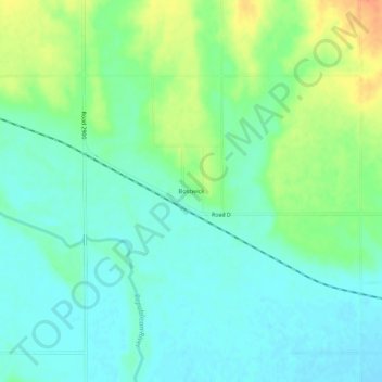
Name: Bostwick topographic map, elevation, terrain.

Location: Bostwick, Nuckolls County, Nebraska, United States (40.02835 -98.20421 40.06835 -98.16421)

Average elevation: 1,627 ft

Minimum elevation: 1,578 ft

Maximum elevation: 1,732 ft

Nuckolls County trails, hiking, mountain biking, running and outdoor activities

Other topographic maps

Click on a map to view its topography, its elevation and its terrain.

Oak

United States > Nebraska > Nuckolls County

Average elevation: 1,611 ft

Gear up for your next adventure:

❄️Traction Cleats - Prevent slips on icy trails during winter hikes
🌐World Map Poster - Decorative world maps with topographic info
😴Insulated Sleeping Pads - Compact and warm pads for high-elevation camping
🔪Outdoor Multitools - Essential survival tools for gear repair and field use
🧢Sun Protection Hats - Wide-brimmed and UPF-rated hats for high-altitude sun safety

As an Amazon Associate, this site earns from qualifying purchases at no extra cost to you.