Geolocate

Sandy Point topographic map

Click on the map to display elevation.

About this map

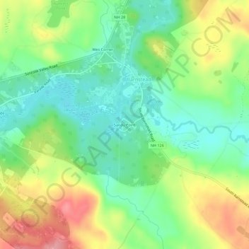
Name: Sandy Point topographic map, elevation, terrain.

Location: Sandy Point, Barnstead, Belknap County, New Hampshire, 03218, United States (43.31247 -71.28244 43.35247 -71.24244)

Average elevation: 610 ft

Minimum elevation: 466 ft

Maximum elevation: 833 ft

Belknap County trails, hiking, mountain biking, running and outdoor activities

Other topographic maps

Click on a map to view its topography, its elevation and its terrain.

Gear up for your next adventure:

🩹Survival Bandages - High‑quality bandages for emergencies
🧭GPS Watch Accessories - Bands and chargers for GPS watches
☀️Outdoor Sunscreen - High protection sunscreen for outdoor activities
🎒Day Hiking Backpack - Lightweight backpack perfect for day trips and outdoor adventures
🏕️Family Camping Gear - Essentials for group camping trips

As an Amazon Associate, this site earns from qualifying purchases at no extra cost to you.