
Kangundo topographic map
Click on the map to display elevation.
About this map
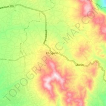
Name: Kangundo topographic map, elevation, terrain.
Location: Kangundo, Machakos, East Kenya, Kenya (-1.34338 37.30729 -1.26338 37.38729)
Average elevation: 5,203 ft
Minimum elevation: 4,331 ft
Maximum elevation: 6,070 ft