
Nasrallah topographic map
Interactive map
Click on the map to display elevation.
About this map
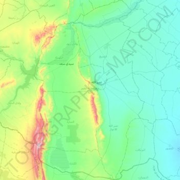
Name: Nasrallah topographic map, elevation, terrain.
Location: Nasrallah, Kairouan, Tunisie (35.16611 9.68127 35.50865 9.96492)
Average elevation: 771 ft
Minimum elevation: 318 ft
Maximum elevation: 2,513 ft
Other topographic maps
Click on a map to view its topography, its elevation and its terrain.
Hajeb El Ayoun
Tunisie > Kairouan > Hajeb El Ayoun
Hajeb El Ayoun, El Hajeb Centre, Bouhajla, Kairouan, Tunisie
Average elevation: 1,106 ft
Oued Zeroud
Oued Zeroud, Abida, Echebika, Kairouan, 3151, Tunisie
Average elevation: 331 ft
El Ain El Beidha
El Ain El Beidha, Haffouz, Kairouan, Tunisie
Average elevation: 938 ft
Oued El Jabbes
Oued El Jabbes, Haffouz, Kairouan, Tunisie
Average elevation: 1,188 ft