
Thank you for supporting this site ❤️
Make a donation
Make a donation
Gear up for your next adventure:
As an Amazon Associate, this site earns from qualifying purchases at no extra cost to you.
Beaumont topographic map
Click on the map to display elevation.
Thank you for supporting this site ❤️
Make a donation
Make a donation
Gear up for your next adventure:
As an Amazon Associate, this site earns from qualifying purchases at no extra cost to you.
About this map
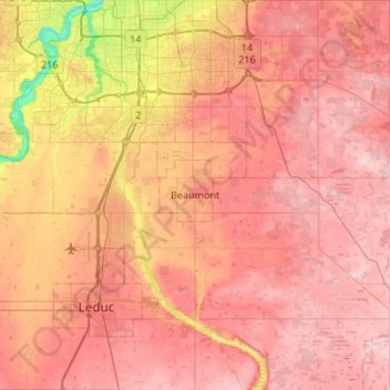
Name: Beaumont topographic map, elevation, terrain.
Location: Beaumont, City of Beaumont, Alberta, T4X 1A4, Canada (53.19255 -113.57514 53.51255 -113.25514)
Average elevation: 2,382 ft
Minimum elevation: 2,024 ft
Maximum elevation: 2,582 ft
Thank you for supporting this site ❤️
Make a donation
Make a donation
Gear up for your next adventure:
As an Amazon Associate, this site earns from qualifying purchases at no extra cost to you.